Map view
The main map view allows to you to browse and view data on a map of the world. You can pan, tilt and zoom the map using your mouse.
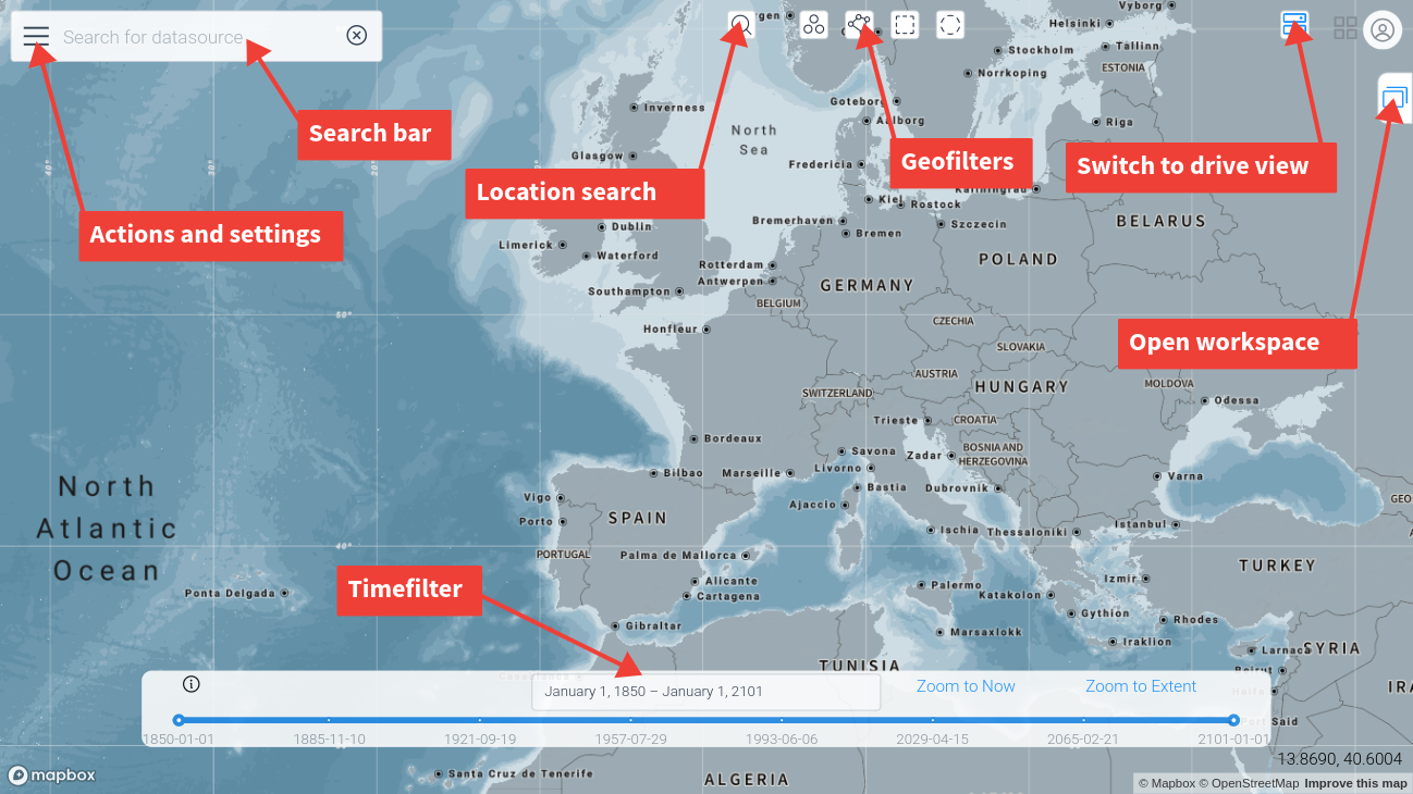
There are controls for:
-
Entering text search terms
-
Drawing a Geofilter
-
Setting a Timefilter
-
Opening the workspaces view
-
Changing the view settings
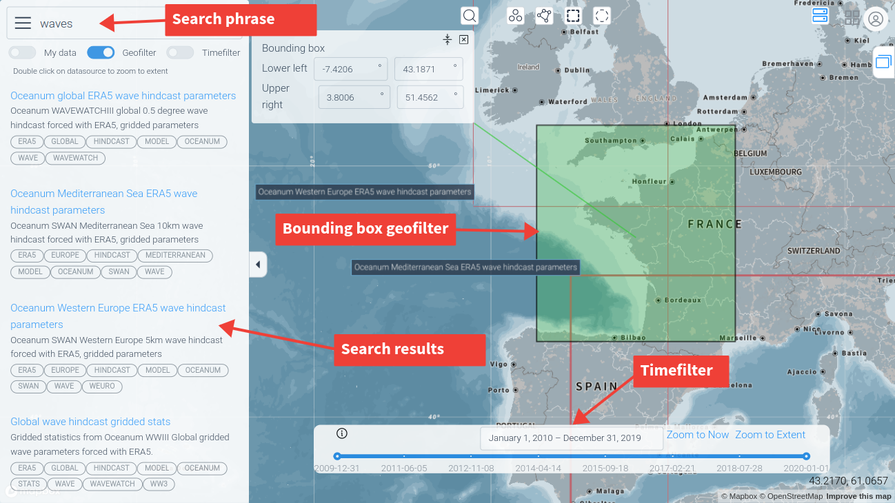
Searching for data
To search for datasources, enter any text in the search bar. Optionally set a Geofilter and/or Timefilter. The datamesh will be scanned for any metadata which matches the search terms, optionally filtered by geometry and time.
The results of the search will be shown in the search bar drop down and on the map. Click on an item in the drop down list or on a map outline or label to open the datasource.
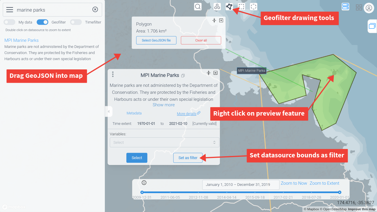
Geofilter
A geofilter is a geographical filter that can be a polygon or set of points. You can set a geofilter in 4 ways:
-
Using the filter drawing tools for points, radius, polygon or bounding box.
-
Dragging a GeoJSON file into the map window. The first feature in the file will be used as the geofilter.
-
Using the geometry of a datasource as a geofilter selector
-
Right-clicking on a feature in a datasource preview - the selected feature will become the geofilter.
Timefilter
The timeslider can be used to set the current timefilter extent. Move the two ends of the slider to set the start and end of the filter time interval. The full extent is automatically set by the maximum extent of all available datasources.
You can zoom in and out on the slider by using the mouse wheel
Actions and settings
You can change the options for how data is displayed on the map in the map options.
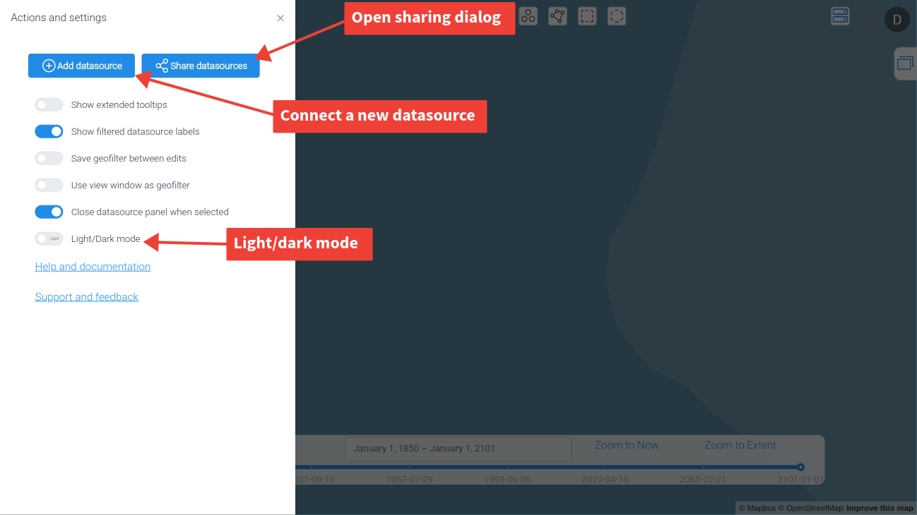
There is also a dark mode option, and action buttons for sharing and connecting new datasources.